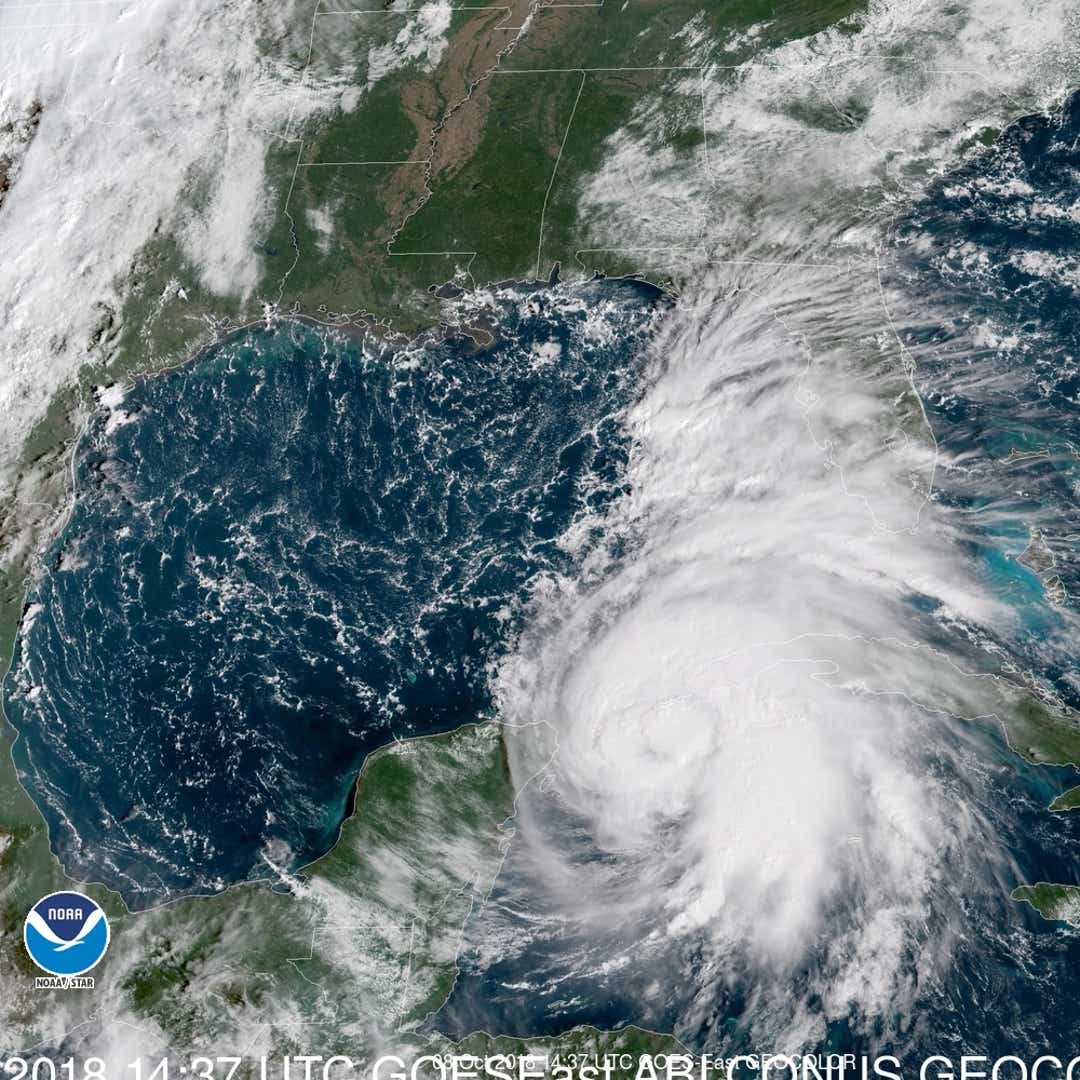
Hurricane Michael is heading for a landfall as a major hurricane with 115-mph winds along the Gulf Coast on Wednesday, prompting a hurricane warning for the region.
Florida Gov. Rick Scott said Michael is a “monstrous storm” that has the potential to devastate the Florida Panhandle.
"Michael could be one of the worst hurricanes to ever strike the Florida Big Bend and Florida Panhandle region," warned Weather Channel hurricane expert Rick Knabb.
Maximum sustained winds increased to nearly 80 mph with higher gusts, the National Hurricane Center said. Steady to rapid strengthening is expected for the next day or so. Michael is forecast to become a major hurricane by Tuesday or Tuesday night and should make landfall Wednesday afternoon or evening.
"Michael could produce three life-threatening hazards along portions of the northeastern Gulf Coast: storm surge, heavy rainfall and hurricane-force winds," according to the hurricane center.
Because of the storm surge threat, three Florida Panhandle counties issued mandatory evacuation orders.
A hurricane warning was posted for the Florida Gulf Coast, all the way from the Alabama-Florida border to the Suwannee River in Florida. A storm surge of up to 12 feet is forecast for a large section of the Florida coast.
According to the hurricane center, one potential impact from a Category 3 hurricane is that "electricity and water will be unavailable for several days to weeks after the storm passes."
A major hurricane is a Category 3, 4 or 5 hurricane, which has winds of at least 111 mph. If the forecast is correct, Michael would be the 11th major hurricane to hit Florida in October since records began in 1851, Colorado State University meteorologist Phil Klotzbach said.
Scott declared an emergency in 35 counties and asked President Donald Trump for help.
More: Track Hurricane Michael
“Take this seriously and keep your family safe,” Scott said from Bay County on Monday. “We know that a storm like Michael can be devastating and deadly.”
Florida State University announced it will close from Tuesday through Friday this week.
Scott said 500 Florida National Guard members were activated for planning, logistics and response, and 5,000 stood at the ready.
"Do not take a chance on storm surge," Scott said. "This storm will be life-threatening and really dangerous. This is coming very fast."
Alabama Gov. Kay Ivey declared a state of emergency in her state, "in anticipation of widespread power outages, wind damage and debris produced by high winds and heavy rain associated with Hurricane Michael."
The National Weather Service in Tallahassee said, "This is a storm to definitely take very seriously. Storm preparations should be rushed to completion today and Tuesday."
Late Monday afternoon, Michael was centered about 30 miles off the western tip of Cuba and about 520 miles south of Apalachicola, Florida. It moved to the north at 9 mph.
After the storm moves inland, it could dump additional unwanted rain on the Carolinas, which were battered by Florence in September. "Areas hit hard by Florence may face disruptions to ongoing cleanup efforts or renewed flooding depending on the track of the storm," AccuWeather senior meteorologist Kristina Pydynowski said.
Michael is the seventh hurricane of the 2018 Atlantic hurricane season.
In the Pacific, Hurricane Sergio spun about 1,300 miles southwest of Mexico's Baja Peninsula. It's forecast to move toward the Baja this week and make landfall as a tropical storm by week's end.
A separate storm system is forecast to drench the central USA in heavy rain this week. Flash flooding is possible in portions of Texas, Oklahoma and Kansas.
Contributing: Karl Etters, the Tallahassee Democrat; Amber Roberson, USA TODAY Network
https://desimpul.blogspot.com/2018/10/hurricane-michael-forecast-to-hit-gulf.html
No comments:
Post a Comment